THE PROBLEM TERRASENSE SOLVES
Connecting What Cell Networks Can’t Reach
Remote operations can’t rely on cell reception. TerraSense connects what matters most, including people, vehicles, wildlife, assets and more, without needing either.
It links local clusters of people, animals and assets across vast landscapes and back to base, giving teams the visibility to act, coordinate and respond with confidence.
No cell signal
Fragmented teams
Limited visibility
Disconnected assets
Subscription-heavy
systems
WITHOUT TERRASENSE
Decentralized network
Connected Environments
Teams linked to base
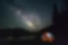
Works in the most remote environments
No subscription required
WITH TERRASENSE
TerraSense gives remote operations the visibility to act, without depending on the networks that fail them.


Greater Insight
Less Impact
See more of what matters, with less disruption to the environments, wildlife and people around us.


Operations
Track beyond where signal ends
Wildlife
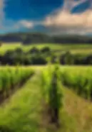
Designed for remote
environments
People
Monitor activity
clearly
Assets
Coverage that
moves
Sensors
Capture live data from the field
Connection Beyond Coverage
Connecting people, assets, sensors and environments through the TerraSense network.
Wildlife
Designed for remote
environments
Assets
Coverage that
moves
Track beyond
where signal ends
People
Monitor activity
clearly
Sensors
Capture live data
from the field
Scroll to explore →


mapping


Communications

Task management


sos & emergency


Reporting


Offline operations


Growing Real-World Insight
Every deployment strengthens the TerraSense network, expanding operational understanding across dynamic operational environments.
3,5 Million +
Hectares
Covered
Supporting visibility across large-scale, remote and operationally complex environments.
2 Million +
Positional Points
Collected Per Month
A growing layer of field data helping teams understand movement, activity and operational patterns.
1000 +
Positional Points Per Asset Per Day
Continuous insight gathered through real-world deployment and daily operational use.